Fieldnote: Finding Silt
The French ROCCH network (Réseau d’Observation des Contaminants Chimiques, Chemical Contaminants Observation Network) carries out sediment sampling activities in French waters since 1993. Following the Oslo and Paris Convention (OSPAR), devised to prevent and eliminate pollution from offshore resources, and implementing European directives, ROCCH examines the chemical properties of the marine environment through regular measurements of chemical concentrations in sediment as well as coastal mollusks. Monitoring activities are carried out every six years in all of France by the French National Institute for Ocean Science and Technology (IFREMER) and financed jointly by local French water agencies. According to the ROCCH network, representative sampling allows for a coverage of the entire French coastline, a monitoring activity that all OSPAR and EU signatories commit to.
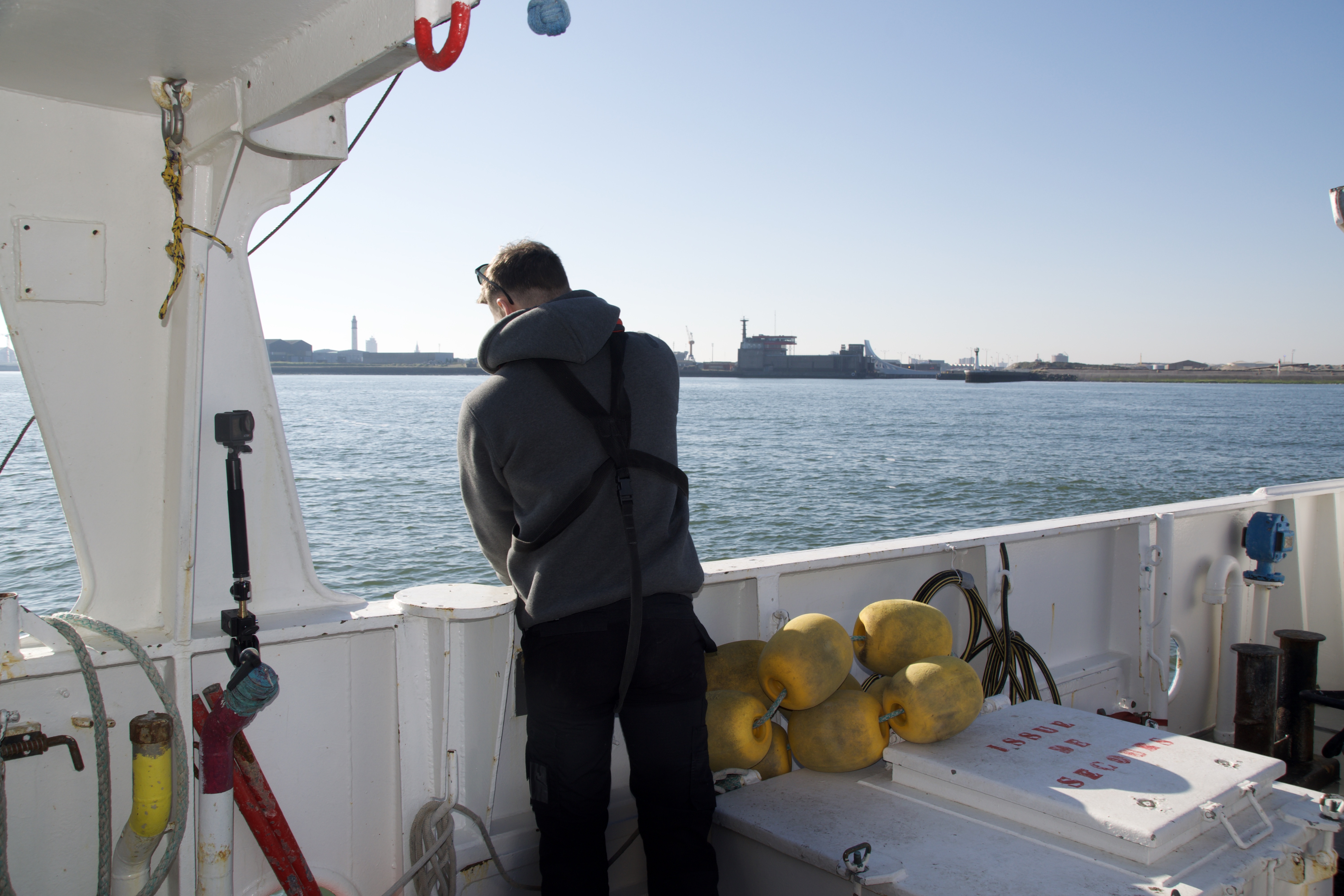
In the spring of 2025, I joined a sampling campaign in the English Channel, which marked the fifth consecutive investigation of this body of water. I wanted to know how knowledge about the chemical properties of sediment is made – what heuristics, technologies, and labour are necessary to excavate and make visible the traces of industrial activity in the seabed? The last time La Manche (the English Channel), roughly stretching from the Belgium border to the Bay of Mont-Saint-Michel in Normandy, underwent sampling was in 2019.
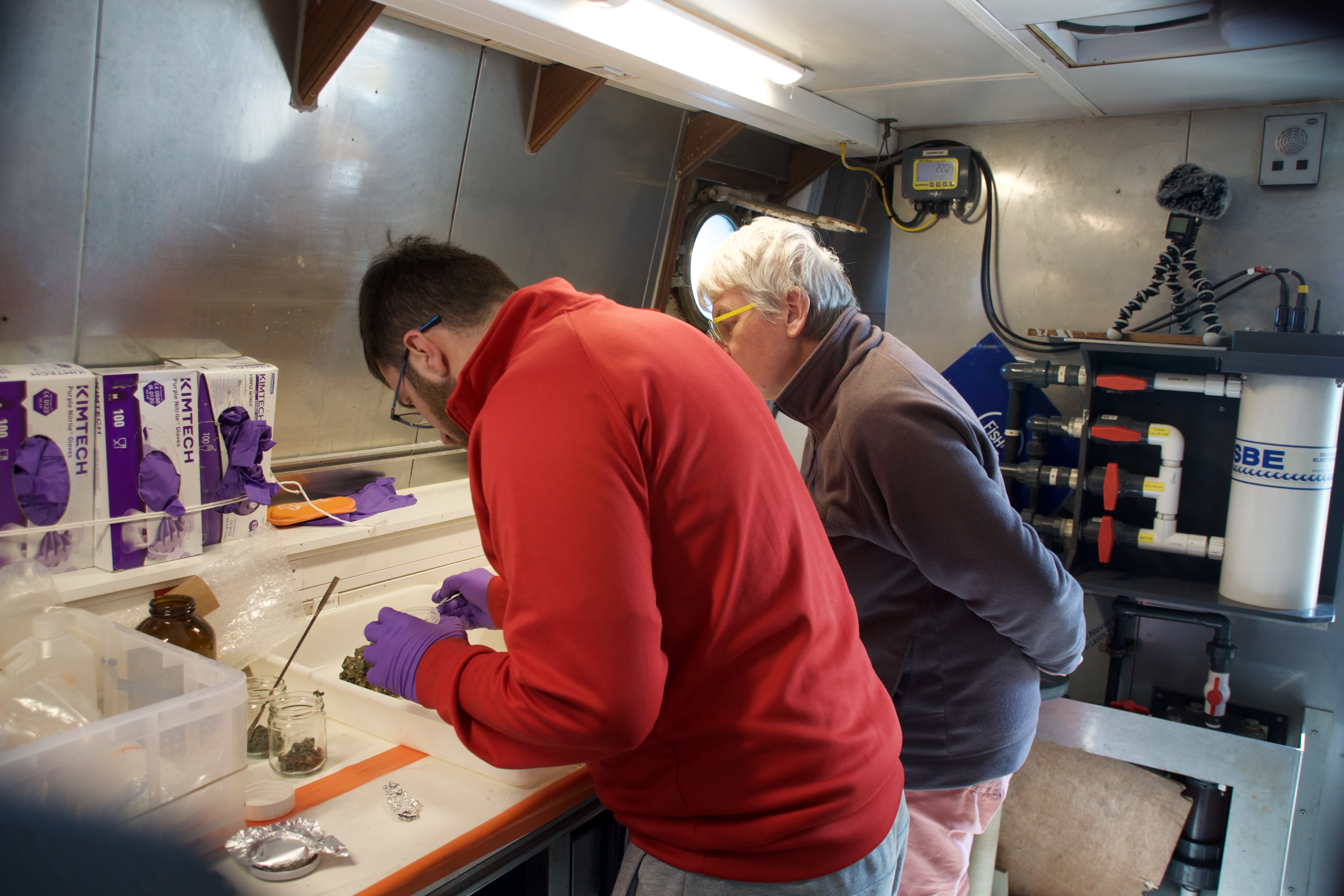
As stated in a preparatory statement communicated to the crew of the scientific ship, a group of IFREMER employees with a background in sediment sampling would carry out sediment extractions on 9 days over a span of 11 days, with most nights spent out on the water. I joined the first leg of the expedition, spending a total of 5 nights on the Côtes de la Manche, a 25m long vessel built in 1997 in France and specialized in coastal oceanographic research. The ship contains a small roofed lab equipped with sampling instruments and screens. The relatively large sampling devices submerged by the ship’s crew are stocked on deck. The boat can accommodate up to 15 passengers, including crew members.
Samples were collected with four different scooping devices that are often named after their inventors. Most frequently, the Reineck box core sampler, a contraption named after German marine geologist Hans-Erich Reineck, was used to extract “undisturbed” sediment samples from a depth of around 30 meters. The Fantacore sampler retrieved samples from spots where the scientists were interested in obtaining several tightly stacked layers of sediments.
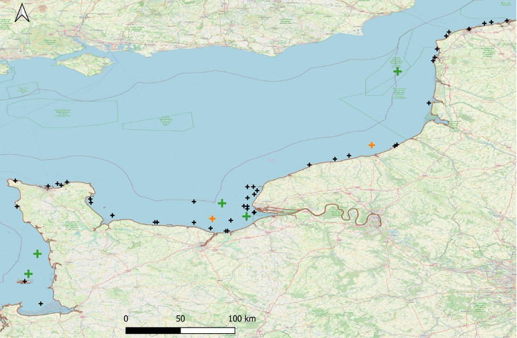
The spots were carefully preselected to cover the entire research “sector.” In addition to striving for a representative sample, the selection of sites owed to recorded coordinates of previous campaigns. Their geolocations served as reference points and guided the campaign to spots that would allow them to “update” prior assessments. The captain and his crew, who had received the coordinates prior to departure, steered the boat along a trail of traces left by the former research campaign.
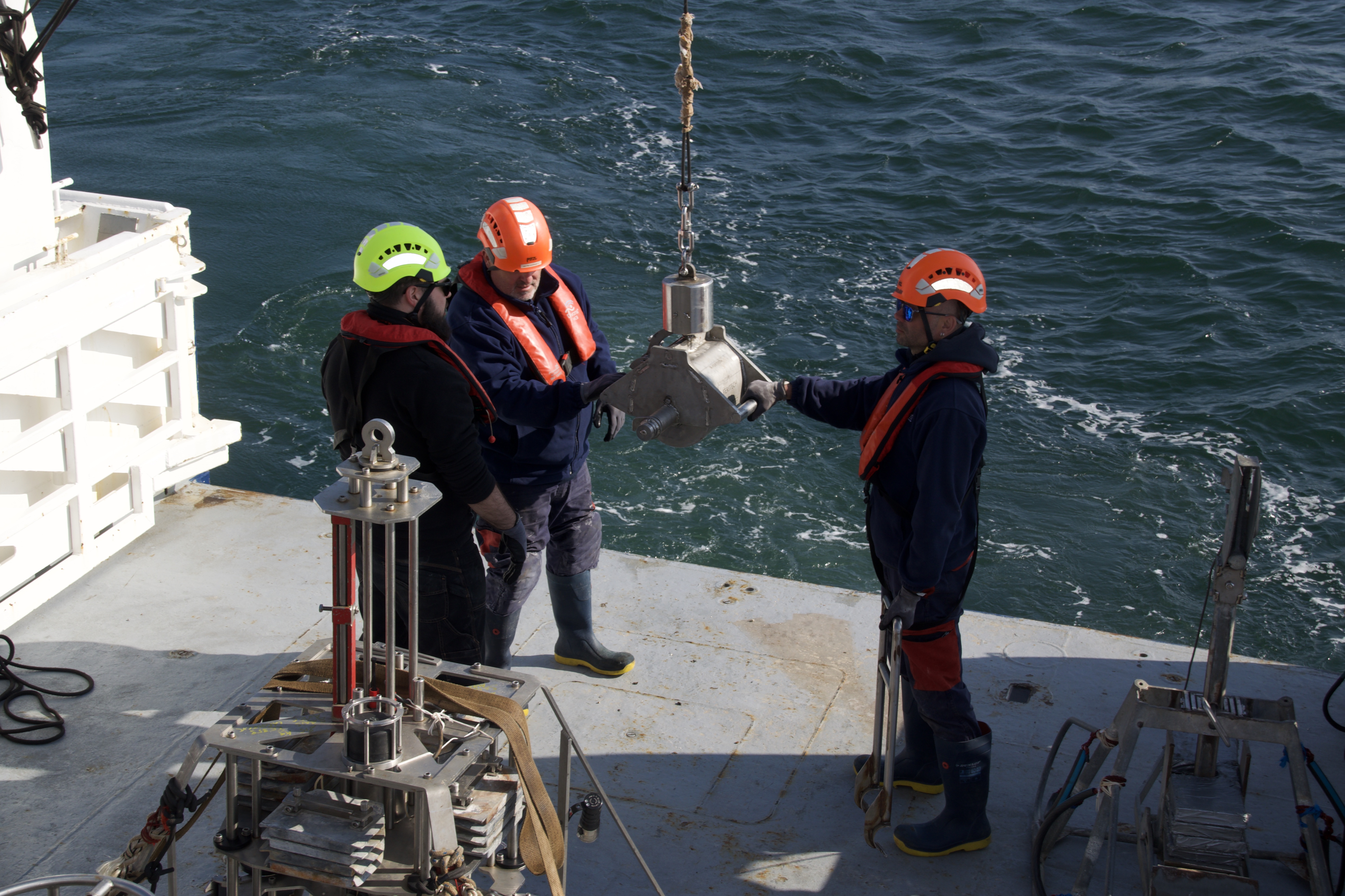
These traces were not visible to us. They were fixed points on a map of geocoordinates, which traced out an oblique spatial pattern under the sea. As it turned out, it was not only challenging to pilot the boat to the exact locations, given strong winds, current, and high waves. Another problem was the elusiveness of the right sample. While the team could easily access and sample the seabed underneath the boat, after the captain had reached the mapped position, the stuff often didn’t match the criteria for lab analysis – if it was too rocky, dislocated pebbles could jumble up the sample; if it was too sandy, they couldn’t access sufficient silt particles. In other words, mapped sample locations did regularly not yield “good samples.” A positive sample consisted of a box corer returning from the seabed filled with a soft, greyish mass, which reminded me of the texture of gelato.
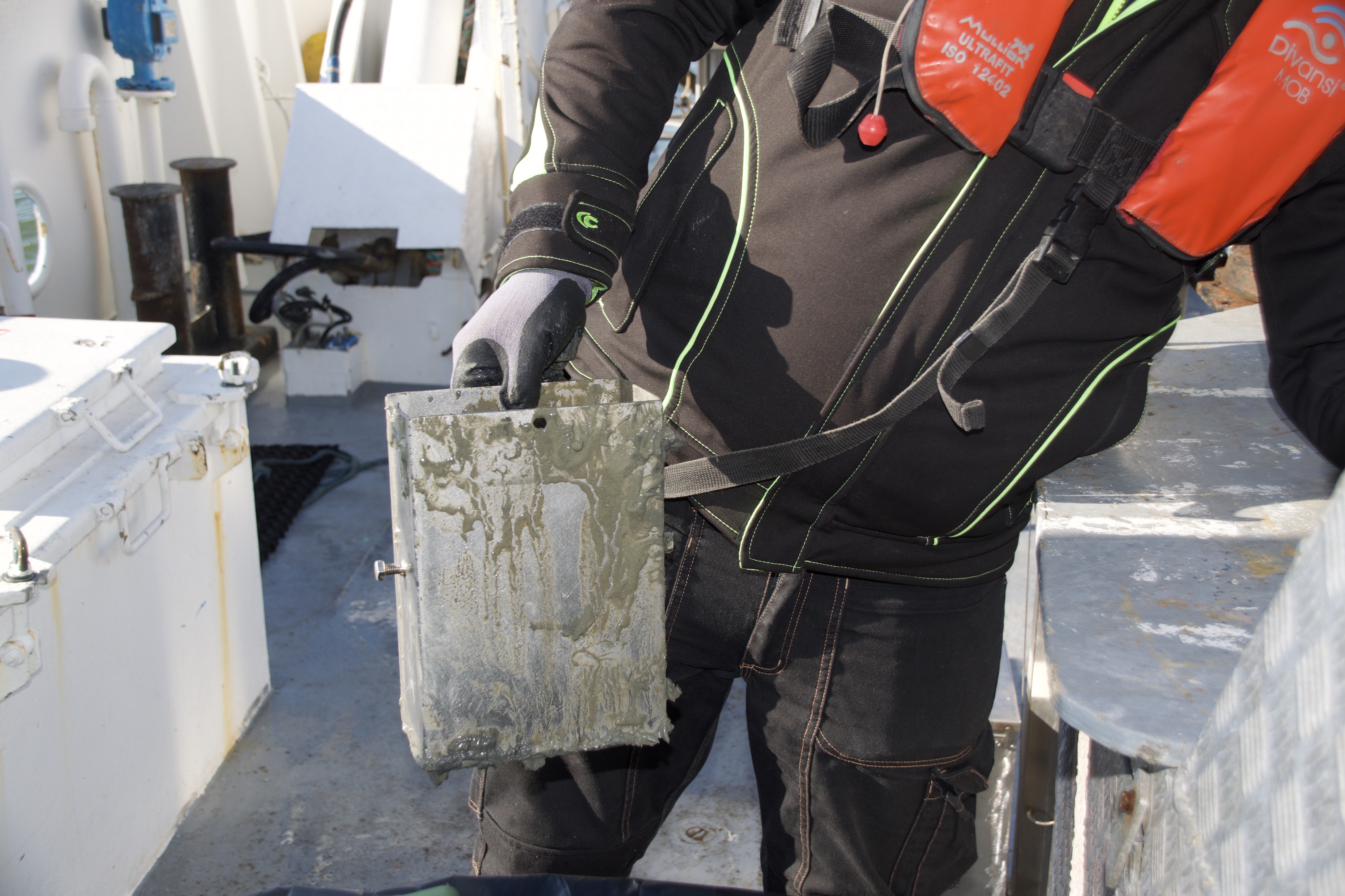
Finding silt was equally important for deep core sampling. For the first time in its history, the mission featured a brand-new component, namely the search for “regional geochemical background values” to calibrate contemporary values. Background values are pre-industrial levels of pollution. The team required long sediment cores to make assessments of historical pollution values and compare them with today’s levels. Scientists and crew had to work together to find material that could provide insights into progressive pollution. Here, the materiality of the ground was equally paramount. On a total of 5 pre-established points, the team planned to sample the sedimentary column by digging deep into the ocean ground, between 60 to 80 cm, using a so-called interface corer. Drilling into the ground was difficult, when hard layers resisted penetration. Silt, on the contrary, allowed for a frictionless immersion of the tubes.
On board, there was a lot of speculation about the reasons for repeated incidents of failing to locate silty grounds. Both scientists and crew members ventured explanations for hitting solid ground where the previous campaign had chanced upon good samples. From the deck, we had little way of knowing the geological properties of the seabed below. While a camera deployed by a crew member helped scouting ground layers amenable to sampling, camera sightings of silt were not a reliable indicator. Even when the live feed from the bottom of the ocean, conveyed by cable, initially indicated soft grounds, the sampling devices sometimes came up stuffed with useless pebbles, or worse – bent out of shape from hitting a hard surface. This was particularly vexing to the scientistic crew who feared forfeiting valuable sampling material.
A more reliable purveyor of ground-level information was the Shipek device, a heavy scooping device that resembles a small dredger bucket. If the Shipek box came back filled with pebbles, the ship had to shift its position or the spot was simply abandoned. If it came up filled with fine silt particles, a well-oiled machinery of science in action was put in motion: in a sudden frenzy, scientists and crew sprung into motion and began hauling up boxes of silt following a rehearsed series of manual acts.
While aboard the research vessel, I became intrigued by the difficulty of evidencing pollution. And how the material spectrum and mobility of ocean sediment complicated the process of unearthing knowledge on environmental degradation. Since 2024, I have been privileged to join meetings of the Spectrality Working Group organized by Amy McLachlan. McLachlan and the members of the group think of the spectral as something that is only partially visible and available to experience and knowledge. While spectral things often resist being known or traced to a source or act, they can be “crucially constitutive of formations of power.” I believe that the working group and the crew of the scientific vessel aspire to a kind of “spectral attunement” to worlds in the making.
More to come.